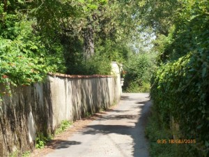
An easy hike in part on a paved road with height differences. Water can be refilled near Croce a Varliano. Refreshments: in Bagno a Ripoli and Croce a Varliano.
Circular route
Difficulty: E T
Access: Piazza della Vittoria car park (Bagno a Ripoli 75 m.)
Time: 5 hours
Coordinates: Bagno a Ripoli, 43° 45′ 12″ N 11° 13′ 60″ E
The route
Bagno a Ripoli – Baroncelli
From Piazza della Vittoria we go along Via Matteotti, Via I Maggio and then Via Roma uphill. In this first part we observe the Town Hall which houses the municipal offices since 1931 and the local police station, located in Via Matteotti.
At the end of Via I Maggio stands the simple façade of the Oratory of San Nicola di Bari, dating back to 1860.
Ascending Via Roma we reach Via Enriquez-Agnoletti and Via Torta which steeply climbs up to Baroncelli (164 m). Here we see the sixteenth-century facade of Villa Il Crocicchio. A plaque, almost illegible, affixed to the door in 1869, remembers Niccolo Machiavelli in the fourth centenary after his birth.
With a short detour to the right, we can reach the church of Baroncelli, located on top of the hill.
Going back, we continue on Via di Baroncelli, which advances narrowly between a wall and a row of old buildings upon which stands a tabernacle with a marble relief of the Madonna and Child. A few steps ahead we notice the Oratorio del Crocifisso (Oratory of the Crucifix). The church, guarded by two slender cypress trees, houses a fresco depicting a scene of the Crucifixion inside and is currently being carefully restored. On the right is the Baroncelli Cemetery, dating from the second half of the nineteenth century. with in a nice Greco-Roman style loggia.
Amongst soft ascents, curves and descents lined by fields and meadows we reach Villa La Colombaia also called Ramione or Baroncelli I.
Having reached the complex of a former farmhouse, fully restored and converted into a residential building we turn left. The dirt road leads to Centanni and then to Croce a Varliano.
Centanni – Croce a Varliano
Via di Centanni advances flatly into the countryside and reaches the farmhouse of the same name which derives from the downgrading of a medieval noble house dating, presumably, from the end of the thirteenth century. The complex, now largely restored, has a cut-off tower that, in farming times, was used as a loft.
Continuing onwards we reach Villa Prosperi (1884), where the clearing that had once been the farmyard of the farmhouse survives.
Further ahead, half-hidden by greenery, we catch a glimpse of Casa La Croce.
The road reaches Croce a Varliano, the village, flanking the provincial road Via Roma. It owes its name to the Oratorio della Croce (Oratory of the Cross) built by the Peruzzi in the thirteenth century.
At the intersection of Via Roma with Via della Croce is a beautiful marble sign that used to indicate the presence of an old butcher shop; next to it, now worn by time, lies the Tabernacolo dell’Annunciazione (Tabernacle of the Annunciation), already documented in the sixteenth century.
The excursion continues on Via della Croce which begins to descend into the valley of the Rimaggio.
Torre di Terigi – Il Mulino – Vignalla
Descending, we can see, on the left, a vast residential complex which has had different names over time but has always referred to the surname of those who lived there. In some maps it was called “Andreina”, in fact, in 1820, an estate of the Andreini lords was there. In 1873 it was called “Casa Sbolgi”, while in the years before the Second World War it was named “Torricini”. Today it is locally known by the name “Il Papini”.
The walk continues on Via del Mulino di Vernalese and goes up the valley of the Rimaggio again. After a while we notice the entrance gate of a building on the left that, in 1774, was listed as “Mulino del Bigallo” and in 1873 as “Mulino della Croce” (Mill of the Cross). Observing the complex and the banks of the ditch carefully, we can recognize the tracks of the millpond. After crossing the stream the road climbs, running alongside the building of the former farmhouse I Masselli and reaches the complex of Villa Vecchia, locally known as Casa Rossa (Red House). At the intersection, we turn right on Via Vicchio e Paterno and soon reach the Torre di Terigi.
The road descends until the bridge over the Rimaggio, which is locally known as “Il Borro di Tommasino” (The Brook of Tommasino), an old name which accompanies it until the spring which was presumably named after a settler in the area.
Only after crossing the bridge can we see the irregular and compact construction of the Mulino (Mill). As we continue upwards the road becomes a pleasant lane surrounded by a rural landscape dominated by the olive tree and reaches Vignalla. A short climb later and the road leads into Via di Terzano.
Paterno – Arco del Camicia – Via del Carota
Via di Terzano welcomes us with the white building of the church of Santo Stefano a Paterno flanked by a high bell tower. On the right hand side of the road we find the new boundary wall which continues the tradition of old mural decoration.
Before the church is an anonymous gate leading to the villa named Il Poggio, a sixteenth-century grandiose construction extensively remodeled in the nineteenth century. The gate at the foot of the steps of the church shows instead the nineteenth-century forms of the villa Il Sottopoggio.
Having passed Paterno we come to a crossroads marked by a beautiful tabernacle with a recess containing the Madonna and Child. In front we find the Torre del Camicia also known as Il Tabernacolo.
Continuing onwards, we reach the Arco del Camicia, after which we cross Via Roma to continue in Via del Carota.
The name Carota derives from the surname of the Caroti family, owners in the seventeenth century of Villa La Veduta, which is located in Ponte a Ema at the point where the road branches off.
Via del Carota starts flatly, surrounded by a delicate rural countryside still largely cultivated and slowly descends towards the Rio di Rimezzano.
In this section we note Villa Maria, also known as L’Arco, which, at the end of the nineteenth century, belong to the Bruggisser, a family of Swiss origin who in 1904 founded an important Florentine bank. Further ahead on the right is the building of an old farmhouse now largely restored.
On the left we find the Monastero dello Spirito Santo (Monastery of the Holy Spirit) which houses the cloistered Vallombrosan Benedictine nuns since 1972. The Monastery occupies the space of a former medieval noble farmhouse known as Le Passerine.
Via della Pietrosa – Via dell’Eremo – Baroncelli
Soon we reach Via della Pietrosa (Stony) which owes its name to the numerous pebbles and stones which, in the past, occupied the roadway. Today it is a quiet road lined with olive trees and shaded by oak trees. After a few steps, we find Villa Baroncelli on the left, a building dating from the fourteenth century and remodeled in successive periods. In the nineteenth century it belonged to Giuseppe Poggi. The rest home Santa Teresa has been found in Baroncelli for many years.
At the end of the road we turn, on the right, into Via dell’Eremo. A short climb later and we flank the ancient complex Villa Minerva. After some houses we reach the Villa l’Eremo. The building, surrounded by a large park, was a worker house in the thirteenth century and after three centuries was converted into a villa. The road continues and turns into a pleasant path that flows into Via di Baroncelli. Turning left, we retrace the initial section and descending from Via Torta we go return to Bagno a Ripoli, where, in Piazza della Vittoria, our circular excursion route is brought to an end.
Elisabetta Brunelleschi
La Mappa
[mapsmarker layer=”14″]


