A circular route course in a generally wooded environment covering signposted dirt roads and paths. An entire day may be devoted.
ACCESS: the via del Bigallo (Bagno a Ripoli) car park
DURATION: 5 hours excluding stops
DIFFICULTY: E
WATER SUPPLY: Bigallo
PARKING SPACES FOR PACKED LUNCH: Bencistà, Crociferro, Cipressaia.
Coordinates:
Bigallo: 43° 44′ 17.6″ N
11° 20′ 56.4″ E
Bencistà: 43° 44′ 19.0″ N
11° 22′ 31.8″ E
The route
Via della Bascula – le Fornaci
From the parking area we go down towards the Hospital of Bigallo and then continue onto Via della Bascula. Of note, in front of the entrance of the hospital, are the washhouses with large baths in limestone and sandstone. They were already documented in the cartographies from 1583 and the women of the Bigallo, until the sixties of the last century, have used them for laundry.
Via the Basculla advances flatly with a wide panorama of Florence on the right and the steep slopes of the hill with terraces planted with olive trees on the left.
As we proceed we cannot help but but notice the red chimney of the furnaces surrounded by cypresses and Judas trees that, in spring, light up the southern side of the hill in bright pink.
At the first corner the road climbs steeply and has a view over the whole entire complex of the Bigallo with the roof surmounted by the characteristic bell tower which indicated the presence of a chapel.
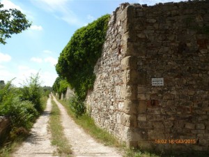
At the end of the ascent it runs alongside a white limestone building, whose crenellated tower presents two openings with pointed arches. We are at the ‘basculla’, the house is named this way because the bascula (weighbridge) for the weighing of lime that was produced in the nearby furnace active in the second half of the nineteenth century was found here. The site, known locally as ‘the vasculla’, then gave the street its name.
We continue to walk following the “Borghi e Colline” (villages and hills) sign that goes up through the woods.
The Roman road – Bencistà – Croce dei Frati.
The road rises and runs alongside another building with battlements that was once a farmhouse belonging to the Le Fornaci farm.
The path turns left and follows the hill halfway up surrounded by a beautiful forest with tall trees (hornbeams, oaks and some pine) and a rich undergrowth of viburnum, blackberry bushes and wild roses. The route follows, in part, a late medieval track which is supposedly of Roman origin. The road which was once called ‘The alternative road of Bencistà’ and also ‘The alternative road of the Monasteraccio’, retains a pavement which is still in good condition in some parts.
Leaving the forest we arrive at Bencistà (428m): there are a few houses lined up on a narrow dirt road, a restaurant and finally the remains of an ancient tabernacle.
From Bencistà we head towards Terzano taking Via Ponti di Millo and following the CAI path no. 6 to the Croce dei Frati (the Terzano passing). This stretch goes alongside the restored building of the former farmhouse La Montanina and the Villa Le Corazze. We walk amongst cultivated olive groves and then abandoned areas that give way to the advancing forest. On our left we catch a glimpse of old farmhouses, a small church and some mansions that make up the town of Terzano.
Finally the trail ends in an open shaded space where several streets converge, a place that is locally known as the ‘Croce dei Frati’ (Cross of the Friars). The name derives from the presence of a wooden cross supported by a sandstone pedestal that was once located near the triangle of forest in the center of the intersections and would indicate the way towards the Convento dell’Incontro. Presumably it had been placed there at the end of the nineteenth century when, as part of restoration work at the monastery, along the roads on the way to the top of the Incontro, some crosses had been raised.
Crociferro – Gorioli – Monte Cucco
From Croce dei Frati (or valico di Terzano – the Terzano passing) the excursion continues on the path CAI OO which we take by proceeding a little forward, on the right, on the other side of the street. The grassy trail climbs steeply towards the Poggio di Crociferro (511 m), a modest summit characterized by low vegetation and shrubs, from which you can enjoy a vast panorama that sweeps from Florence, to the Pratomagno, to the Incontro and Terzano.
The trail reaches an inhabited area dating from the second half of the last century named Montecucco.
Here we leave the CAI path and we start to go down the asphalted Via di Bencistà e Gorioli that runs along the north-east side of Montecucco (473 m). Once we have gone past casa Gorioli and arrived at the intersection, we turn left to return to Bencistà.
Bencistà – Monte Pilli – the Cipressaia – Bigallo
Proceeding on path 6 we will cover Bencistà in reverse, climb to the top of Monte Pilli (489 m) and, going around its summit, reach Cipressaia.
The name, fairly widespread, indicates an artificially planted forest, where cypresses prevail. In this cypress grove many pine trees are to be found, but there are also flowering ash and some oak trees, while broom, cistus, wild roses grow in the undergrowth and … the cypress, instead, only contours the perimeter.
There is an area here which is managed by a committee of hunters who are also owners of a part of the forest.
From the Piazzale of Cipressaia, following the CAI paths, we go down towards Via della Basculla and then towards the Bigallo.
Elisabetta Brunelleschi
The Map
[mapsmarker layer=”12″]


