19.4 C
Firenze
Sunday, May 5, 2024

From Bagno a Ripoli to Antella

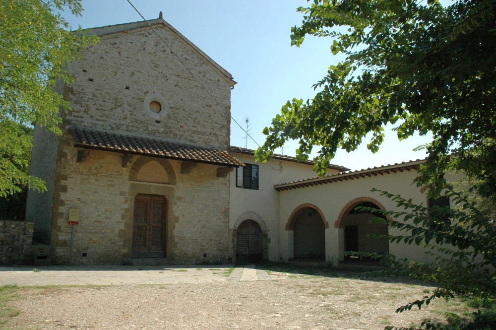
Esterno - Oratorio Santa Caterina

Type of route: dirt road, on foot, mountain bike or horseback.
Duration: 1:50/2:00 hours
Length: 5.60 km
Ascent: 165 m; Descent: 140 m

The route starts from Piazza della Vittoria in Bagno a Ripoli (Coord. GPS N 43 ° 45’05 “E 11 ° 19’11”), in front of the town hall and, from Via 1° Maggio we reach the corner of via Roma, we can see the oratory of San Niccolò di Bari. Going back up, we turn into via Enriquez Agnoletti and then into via Torta, and then arrive in Baroncelli.

The sixteenth-century facade of the Crocicchio villa and – going up on the right – the church of San Tommaso a Baroncelli, are notable. We continue downwards on the via di Baroncelli, then walk on the left on via di Ritortoli, into the Rio Torto valley. At the first junction from via della Pietrosa we go up to Poggio Baronti. Still staying on the left hand side, we find via del Carota that we will walk along towards Ponte a Ema.

The road overlooks the Rio Rimezzano valley, passes by the old building of the La Tavernucole villa and reaches the l’Oratorio di Santa Caterina delle Ruote (The Oratory of Santa Caterina delle Ruote) in Rimezzano.

From here, the walk continues to the left along the gully and after a few steps begins going up towards villa Pedriali.

At the end of the ascent, running along the left hand side of the villa wall, we continue down from Poggio ai Grilli to the farm Ellera. Once we go past the underpass, we go into via dell’Antella and arrive in Piazza Ubaldino Peruzzi, our journey destination.

From Osteria Nuova to Fonte Santa

Type of route: dirt road, on foot, mountain bike or horseback.
Duration: 3:00/3:30 hours
Length: 8.40 km
Ascent: 565 m; Descent: 225 m

The route starts from the Osteria Nuova, Piazza Fratelli Rosselli (Coord. GPS N 43 ° 43’48 “E 11 ° 20’44”), we cross the country by taking the right hand side of via del Borro di San Giorgio, and we go all the way along the road until we pass the highway. After the bridge, turn left and go down into Borro San Giorgio, near white/red signs then take left again along a shady path which flanks the gully and leads to the “Colonie”. The name recalls the heliotherapeutic colonies organized there during the Fascist era along the banks of the stream. The site, now covered by vegetation and partly occupied by gardens, is still detectable on the right side of the Borro. With a few steps to the left, uphill, you can reach the monument dedicated to the partisans Ivo Lazzeri and Giovanni Mutolo.

After crossing the bridge, the road begins to rise gradually into the shady Montisoni woods. Soon thereafter the old house building Il Colto appears, the narrow road runs along its back and then turns immediately left. For a short distance, we proceed amongst the cultivation surrounding the house, and then reenter into the woods. The trail links up again with the dirt road that connects Montisoni to San Donato in Collina; at the junction turn left, towards San Donato. The old road runs across the hillside between mixed forests and chestnut woods, passes by casa Belvedere, skirts alongside villa Baldasseroni and finally, leads to the intersection where the cemetery of San Donato can be found.

During the walk, we encounter some splendid views that look over the surrounding hills and the village of San Donato. From the cemetery continue turning right towards the villas and go straight towards Il Fico. The road, partly flat, proceeds amongst young chestnut and oak trees. Having reached Il Fico continue for a short distance and then turn right, leaving the crossing for il Faeto. The track climbs up towards Poggio Firenze through oak and chestnut woods immersed in a dense undergrowth. Going upwards, the view extends over again over the Upper Valdarno.
Just before reaching the top of the hill take the path CAI 00 (white/red trail), paying attention to the many existing routes in the area. From here, the route continues dropping quickly to the “Pratone” di Fonte Santa. Turning left on the trail of the old via Maremmana, we reach Rifugio and the Fonte Santa.

Croce a Varliano – Vicchio di Rimaggio

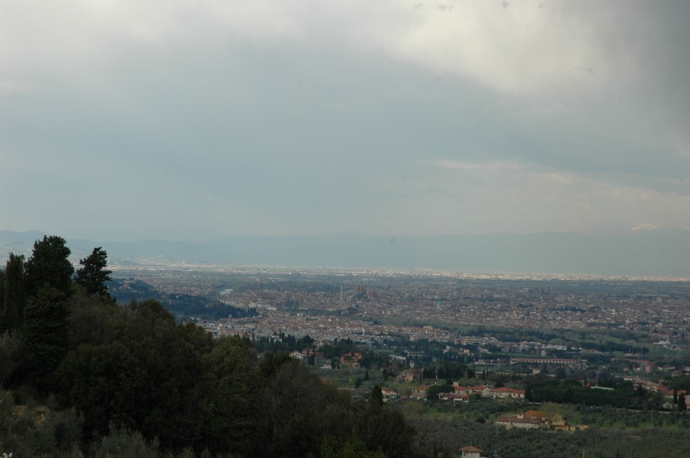
La vista su Firenze

Type of route: dirt road, on foot, mountain bike or horseback.
Duration: 1:50/2:00 hours
Length: 5.10 km
Ascent and descent: 170 m

The route begins in the Piazza di Croce a Varliano (Coord. GPS N 43 ° 44 ’47 “E 11 ° 20’16”). Continue along Via Roma to the Arco del Camicia, built to connect the two side buildings of the Batacchi villa. Having gone past the Arco, along via di Terzano, we find, on the left, the Torre del Camicia (1280), in front of which stands the aedicule that houses a high relief of a Madonna col Bambino (Virgin Mary and Child) (1832-1833) in plaster. We then come to the church of Santo Stefano a Paterno.

Near the church, the left hand side of the road is bounded by walls covered with graffiti typical of the Florentine countryside. Having left at this point the Terzano road, we continue on the Vicchio e Paterno road towards Vignalla. In this part, the Rimaggio valley, mainly cultivated with olive trees, forms a natural amphitheater and offers the sights and surroundings of Florence and the villa Vernalese cypress forest.

Having crossed the Rimaggio ditch, we find the Torre di Terigi, a classic example of a medieval tower house, which formerly belonged to the Peruzzi family.

Shortly after, at the junction with via Mulino di Vernalese, the road goes up towards the Vizzano farm; at the end of the short ascent, you can admire a great tabernacle with a mural painting depicting the Annunciation. The landscape stretches over Florence and Bagno a Ripoli. Having passed the ancient manor houses and others that are more recently built, we reach Vicchio di Rimaggio where the ancient church of San Lorenzo (rebuilt in the fourteenth century) can be found, preceded by an interesting porch with two arches.

We leave via di Vicchio e Paterno and continuing to the left through via della Croce, we arrive at Villa Bellavista and then the Rimaggino tabernacle (early fifteenth century): built as an aedicule supported by columns with Corinthian capitals, it contains a fresco depicting the Madonna col Bambino in Maestà (The Virgin Mary and Child in Majesty).

Having left the tabernacle behind, we go down and cross the Rimaggio stream once again, into the Rimaggino locality. The road continues uphill until Croce a Varliano, where the walk ends.

From Poggio della Pieve to the Valle del Rimaggio

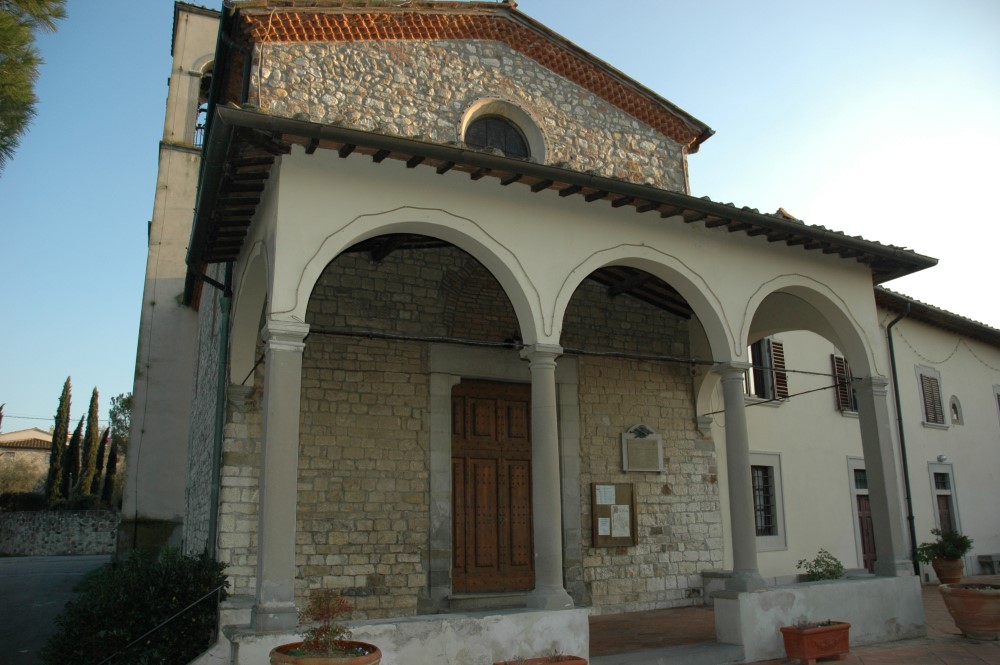
Chiesa di Santa Maria a Quarto

Type of route: dirt road, on foot, mountain bike or horseback.
Duration: 2:30/2:45 hours Length: 7.50 km
Ascent and descent: 180 m

This is a circular route that starts from Bagno a Ripoli’s “I Ponti” (The Bridges) gardens (Coord. GPS N 43 ° 45’11 “E 11 ° 18’54”): from the parking lot in front of Torricella house, proceed along the gravel driveway until you reach the edge of the garden. Turn right into the path that runs along the back of the sports field and into the now uncultivated fields. From here, we can see the bell tower and the apse of the Pieve da San Pietro a Ripoli (Parish of San Pietro a Ripoli).

The trail is linked to the Via Vicinale del Poggio della Pieve, which is now reduced to a simple path, and rises up from the church to the hill of the same name.

Soon the old road enters into the forest and continues uphill, flanked by high cypress trees. At the second junction, turn right. After a few steps, the forest gives way to the fields where you can enjoy a wide panorama of Sorgane, the Pian di Ripoli and Florence.

Upon reaching the top of the hill, you can see the Belmonte complex (manor house and farm) on the right. Go down towards the left into the Rio Torto (Ritortoli) valley and you will be able to see the Poggio Baronti, Baroncelli and, further on, Monte Pilli before you.

After the descent, take the left on via di Ritortoli, cross and go up taking the right on via dell’Eremo.
The road rises up passing by villa Minerva and many characteristic former farmhouses.
Once you have passed by villa dell’Eremo, the track becomes a grassy path which quickly reconnects with Via di Baroncelli.

Take this road on the right (villa la Colombaia) until the junction marked by the vast and renovated farm complex Baroncelli (formerly called San Ferdinando).

Turn left through the track that winds flatly through the fields up to the Centanni farm, up to villa Prosperi and, hidden by the green of the garden, to the restored farm house la Croce (the Cross), an ancient noble house. In the village of Croce a Varliano we can see the l’Oratorio della Santa Croce (Oratory of the Holy Cross).
Once you have crossed via Roma we descend through via della Croce until we reach Rimaggino, a tiny village characterized by the presence of some old washhouses.

Passing over the creek bridge Rimaggio, we continue along via della Croce: at the end of the climb, we will find the Rimaggino tabernacle and the Gello farmhouse, then the road reaches the large area of open space dominated by the facade of the Bellavista villa. We continue by taking the left through via di Vernalese to arrive, after a few curves, at the hamlet of Rimaggio where we can admire the centuries-old cypress trees which give name to the city quarter.

Going into via di Quarto on the left, we go up towards the Del Taglia villa. Once we reach Rosai, we go down towards Quarto, where the beautiful church of Santa Maria overlooks the Pian di Ripoli. Continue onwards until Via Fratelli Orsi and turn left on Via Roma to reach the gardens where the route ends.

Emergency Numbers

Logo_Polizia_municipale

Bagno a Ripoli Municipal Police 055 631111

The Campigliano Ecological Station

The ecological station was built in 2012 by Quadrifoglio Spa to offer an additional service to citizens, allowing for an increase in recycling and delivering of waste that, by type or size, are not compatible with the collection of municipal waste in the locality.

Tabernacles

Description

Bagno a Ripoli is full of tabernacles located throughout the territory.

Antella Municipal Theatre

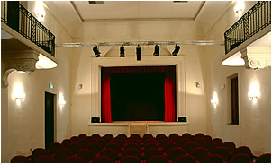
Teatro Comunale di Antella

Description

The Antella Municipal Theatre has had a long and checkered history, a reflection of the political and non-political facts that have characterized Italy from the nineteenth century to today.

Monumental Cemetery

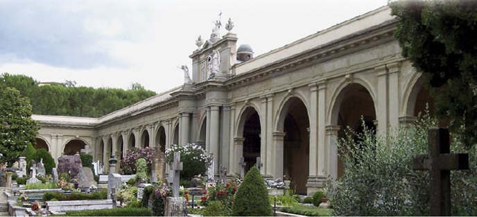
Cimitero Monumentale di Antella

Description

The Venerabile Confraternita di Misericordia di Santa Maria all’Antella (Venerable Brotherhood of Mercy of Santa Maria all’Antella) Monumental Cemetery is among the most famous and important in Italy both for its size and for the works of art collected there.

The cities of art reachable from Bagno a Ripoli

Bagno a Ripoli can easily be considered as the gateway to the beauty of Tuscany and is, in fact, in a strategic position to reach the major Tuscan cities of art.

Primo Piano

Storie d'Impresa

Contatta la Redazione

Leggi e accetta la nuova privacy per il GDPR Europeo 2018 maggiori informazioni

Questo sito utilizza i cookie per fornire la migliore esperienza di navigazione possibile. Continuando a utilizzare questo sito senza modificare le impostazioni dei cookie o cliccando su "Accetta" permetti il loro utilizzo.

Chiudi